Mapping 111 days of sea travel
The Admiral Graf Spee, launched in 1934 was, along with the Deutschland, the first capital ship of the Kriegsmarine to venture into battle. A quick search on the Internet turns up a few route maps, most notably Roskill’s Map 11 from the first volume of his four volume The War at Sea or some version thereof (see below).

This, of course, was mapped by the Royal Navy, using Royal Navy records. But does it conform to what the Germans recorded? After all, the Admiral Graf Spee‘s war diary or Kriegstagebücher is available, albeit only in German. Nevertheless, the dates and geographic coordinates are easy to ready so let’s compare.

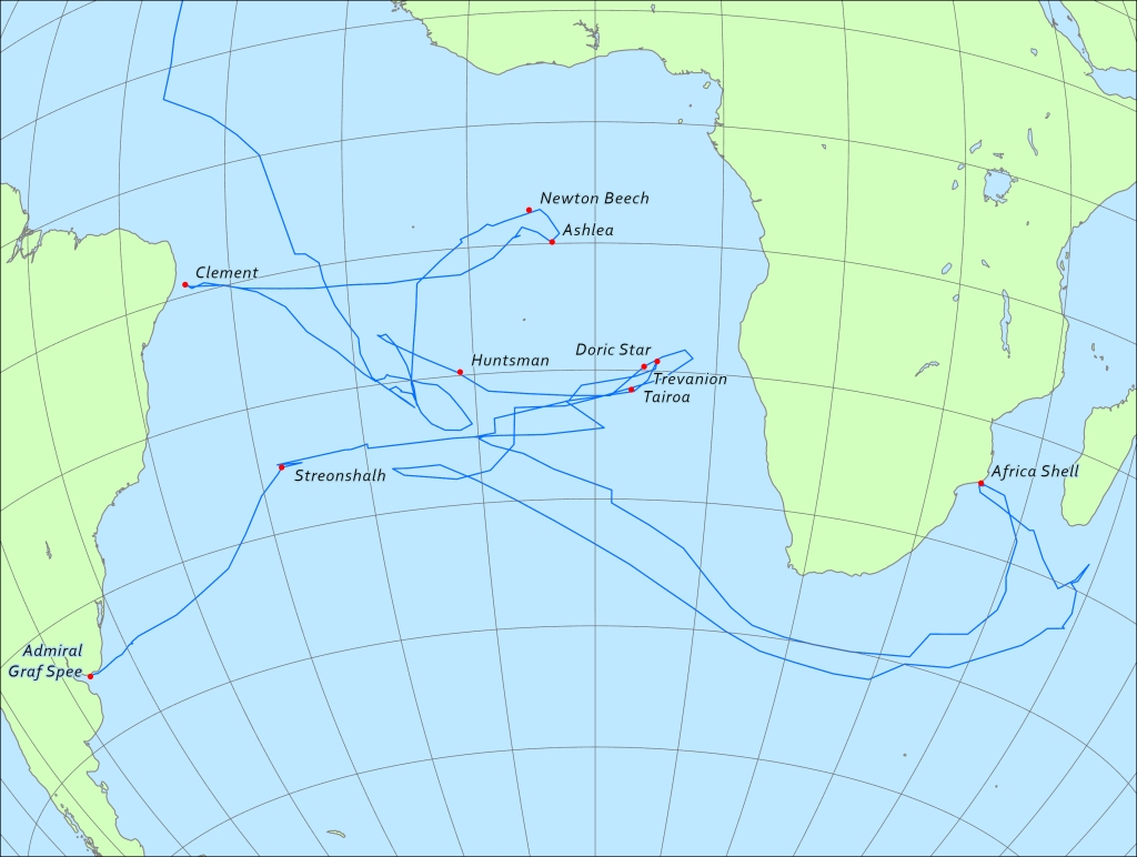
Admiral Graf Spee set sail from Bremerhaven, Germany on August 23, 1939 and was scuttled off Montevideo, Uruguay on December 12, 1939, 111 days. Position readings were taken twice each day, normally once at midnight and once at noon. Along with the occasional position reading taken during a significant event such as a capture or sinking of a ship, we can actually extract 232 different locations. That provides a fairly good indication of the ship’s route. With some additional mapping detail provided from the British HMSO Report on the the Battle of the River Plate, I was able to stitch together a fairly accurate map of the Admiral Graf Spee‘s voyage.
In the map below, the red lines are taken from Roskill’s Map 11, the blue lines indicate the route based on the coordinates given in the KTB. As you can see there are a few significant differences.
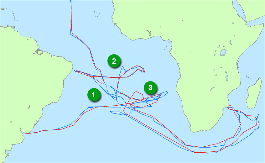
- On Roskill’s map the 3 week period between the time the Admiral Graf Spee reached its patrol area and the time it was given the go-ahead to attack shipping towards the end of September is sketched out and marked as a waiting area with little details as to the ships movements during that period. The KTB indicates a lot of moving around in the area and this is included in the new route map.
- KTB’s can easily have errors in the log and this item indicates one such possible error. The coordinate in question is from midnight on 12th of October and is listed as 7˚ 9′ S, 12˚ 25′ W. Based on the other positions from 12 hours before and after it’s more likely that the position is around 10˚9 S, 12˚25W.
- Finally, as indicated with the blue lines, there was much back and forth over the same area during October 23 & 24 and again on December 2 & 3.
Add in the locations of the 9 ships that the Admiral Graf Spee sunk and the location of the ship’s own demise and we have a far more accurate map: