After the Big Event

Book Review

In the Wake of the Graf Spee by Enrique Dick. Translated by Marilyn Myerscough and published in English 2015, WIT Press.

Original Spanish edition Tras La Estela del Graf Spee, first published in 1999.

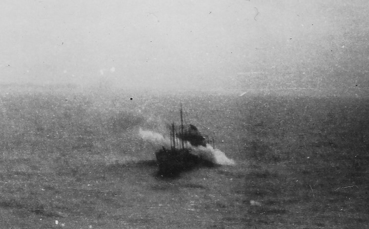
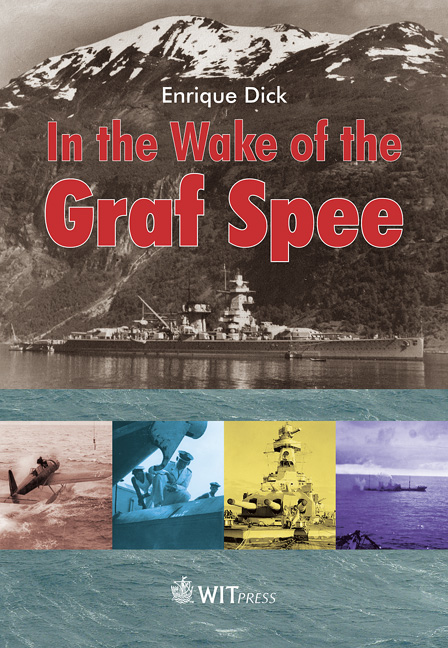
When World War II began in September 1939, the German pocket battleship Admiral Graf Spee was already heading to its assigned patrol area the South Atlantic, where it would target Allied merchant vessels. The ship’s three-month campaign, which included the sinking nine merchant ships, a fierce battle with three British cruisers off the coast of South America, a retreat to Montevideo, and the sinking of the Admiral Graf Spee, is extensively documented. Most accounts focus on the actions and decisions of the Graf Spee’s commander, Captain Langsdorff, whose choices led to the ship’s demise. Typically, these narratives conclude with the ship’s sinking near Montevideo and Captain Langsdorff’s subsequent suicide in Buenos Aires. Eric Grove’s The Price of Disobedience: The Battle of the River Plate Reconsidered is a notable exception, as it also examines the fate of the ship’s remains up to recent times. However, even Grove’s work, like others, provides scant details on the crew’s experiences post-1939, some of whom returned to Germany to continue the war effort, while most were interned in Argentina for the duration of the conflict.

Enrique Dick’s In the Wake of the Graf Spee offers a fresh, though personal,  perspective on this historical episode. While it recounts the Admiral Graf Spee’s voyage, the Battle of the River Plate, and the ship’s sinking, its primary focus is on the crew, particularly Heinrich Dick, the author’s father, who served on the Graf Spee. Rather than providing a complete historical account or a strict biography, Dick narrates the events surrounding his father’s internment in Argentina. The book includes details about the Graf Spee and its war patrol, but these are presented as pivotal moments that drastically altered the lives of Hein and his fellow crew members, setting them on an unexpected journey in Argentina.

The narrative centers on the five years the crew spent in Argentina, initially as internees and later as prisoners of war. Dick focuses on 200 crew members who were sent the small town of Capilla Veija, 750 km northwest of Buenos Aires, where they built their own internment camp and integrated with the local community. The community was largely welcoming, and by the war’s end, some crew members had married local women, hoping to make Argentina their permanent home. However, their forced return to Germany after the war delayed these plans. Heinrich Dick, who married shortly before being deported, spent four years in Germany before rejoining his wife and her family in Argentina where he remained until his death in 1992.

Dick’s portrayal of his father is affectionate and shifts between a personal narrative and a broader, more objective perspective. Although his dedication occasionally leads to overly detailed descriptions, it paints a vivid picture of the 200 men who found themselves stranded in a foreign land. The book primarily focuses on their lives in Argentina, with the war serving as a backdrop rather than a central theme. It suggests that these men were fortunate to find a welcoming community, far removed from the widespread devastation of the war.

Dick’s early life in Germany, his acceptance into the Kriegsmarine in 1938, and his year of service onboard the Graf Spee are covered in the first 110 pages of the book. The remainder of the book focuses on Dick’s time in Argentina and includes some gratuitous coverage of commemorative events marking the sinking of the Graf Spee in 1989, 1999 and 2009. Also included is a technical appendix covering all aspect of the ship.

This book is not a critical assessment of the Graf Spee, it’s commander and crew or of any of the events that occurred in late 1939. The ship, in fact, comes off as a technical marvel for its time. Any of its known shortcomings – the MAN engines that caused severe shaking throughout the ship when run at high speeds, its poor seakeeping and light armour – are not mentioned at all. This book will disappoint those looking for additional insight in the Battle of the River Plate and the decisions that were made. Though this book fails to provide a complete account of what happened to the crew of the Graf Spee after the scuttling of their ship, it does provide a lovely, peaceful snapshot of life during the 1940s, far from the destruction and chaos that overtook much of the world during that time.

Locating the Africa Shell

In late 1939 the German cruiser Admiral Graf Spee went on a raiding journey in the South Atlantic and sunk 9 merchant vessels before encountering the Royal Navy cruisers Exeter, Ajax and Achilles and being cornered in Montevideo, Uruguay. In the middle of this journey, Captain Langsdorff of the Admiral Graf Spee took the ship around the southern tip of Africa and sunk the Africa Shell off the coast of Mozambique before doubling back and returning to the South Atlantic., hoping to confuse his opponents and put them off the chase.

Africa Shell, a smaller tanker of 706 tons, was sighted by the Admiral Graf Spee as it was heading south along the coast for its final destination of Lourenco Marques, still some 170 nautical miles (320 kilometres) away to the southwest. According to the captain of the Africa Shell, Patrick Dove, once the Admiral Graf Spee was sighted, the Africa Shell turned to towards the shoreline in the hopes of escaping into neutral waters. Mozambique was a Portuguese colony at the time and Portugal was officially neutral.

The sinking of the Africa Shell. Photo via MaritimeQuest

Dove writes in his book I Was Graf Spee’s Prisoner that his orders to his navigation officer “were to take the most careful bearings and make a full record of them on paper. I myself checked these bearings.”[1] He insists that the ship was a half mile within the 3 nautical mile limit. Elsewhere in his book he states that “according to the bearings taken by my second officer my position was ten-and-a-half miles southwest by south from Cape Zavora lighthouse, and my vessel was two-and-a-half miles from the shore, and therefore inside the territorial limits of Portuguese East Africa.”[2] The UK Admiralty’s database of wrecks and obstructions puts the location of the Africa Shell at 24° 40′ 00″ South 35° 30′ 03″ East, about 370 m from this location.

The Germans always maintained that the Africa Shell was captured and sunk outside the 3 mile nautical limit so it is no surprise that the location of these events is different in the Admiral Graf Spee’s Kriegstagebücher or war diary (KTB). There Captain Langsdorff of the Admiral Graf Spee records that on November 15, 1939 at 14:06, the Admiral Graf Spee captured and sunk the Africa Shell at 24° 48′ South, 35° 01′ East.[3] This is approximately 9.7 nautical miles (18 km) from Dove’s stated position and 8.4 nm (15.5 km) from the Mozambique shoreline.

Of course, location measurement wasn’t an exact science in 1939 as it is today with GPS units and cellphones that give you a fairly precise location. If the weather was rough or the skies overcast, it could be tough or impossible to take any reading. Even on a good day measurements using a sextant – the instrument of the time – were +/- a half mile or so. Dove and his navigator could easily have been off as might have the Admiral Graf Spee. On top of that, both parties were motivated to state the accuracy of their claim so some allowances might have been made.

To my knowledge, the exact location of the wreck of the Africa Shell has not been mapped. Doing so would go far in clarifying whether or not the ship was sunk within territorial waters. However, even if the ship was sunk within territorial waters, it would have been unlikely to have had much affect on events. The Portuguese government might have sent a letter of protest to the German government and the Germans might have at the most, made a half-hearted apology. In any case, by the time that would have happened, the Admiral Graf Spee would have long disappeared again into the South Atlantic.


[1] I Was Graf Spee’s Prisoner, Patrick Dove, Viking Press, 1956, p.93

[2] Ibid, p. 77.

[3] Kriegstabebuch des Kommandanten Kapitän zur See, Hans Langsdorff, p. 147

The Cruise of the Admiral Graf Spee

Mapping 111 days of sea travel

The Admiral Graf Spee, launched in 1934 was, along with the Deutschland, the first capital ship of the Kriegsmarine to venture into battle. A quick search on the Internet turns up a few route maps, most notably Roskill’s Map 11 from the first volume of his four volume The War at Sea or some version thereof (see below).

This, of course, was mapped by the Royal Navy, using Royal Navy records. But does it conform to what the Germans recorded? After all, the Admiral Graf Spee‘s war diary or Kriegstagebücher is available, albeit only in German. Nevertheless, the dates and geographic coordinates are easy to ready so let’s compare.

Admiral Graf Spee set sail from Bremerhaven, Germany on August 23, 1939 and was scuttled off Montevideo, Uruguay on December 12, 1939, 111 days. Position readings were taken twice each day, normally once at midnight and once at noon. Along with the occasional position reading taken during a significant event such as a capture or sinking of a ship, we can actually extract 232 different locations. That provides a fairly good indication of the ship’s route. With some additional mapping detail provided from the British HMSO Report on the the Battle of the River Plate, I was able to stitch together a fairly accurate map of the Admiral Graf Spee‘s voyage.

In the map below, the red lines are taken from Roskill’s Map 11, the blue lines indicate the route based on the coordinates given in the KTB. As you can see there are a few significant differences.

  1. On Roskill’s map the 3 week period between the time the Admiral Graf Spee reached its patrol area and the time it was given the go-ahead to attack shipping towards the end of September is sketched out and marked as a waiting area with little details as to the ships movements during that period. The KTB indicates a lot of moving around in the area and this is included in the new route map.
  2. KTB’s can easily have errors in the log and this item indicates one such possible error. The coordinate in question is from midnight on 12th of October and is listed as 7˚ 9′ S, 12˚ 25′ W. Based on the other positions from 12 hours before and after it’s more likely that the position is around 10˚9 S, 12˚25W.
  3. Finally, as indicated with the blue lines, there was much back and forth over the same area during October 23 & 24 and again on December 2 & 3.

Add in the locations of the 9 ships that the Admiral Graf Spee sunk and the location of the ship’s own demise and we have a far more accurate map: