What is this all about?
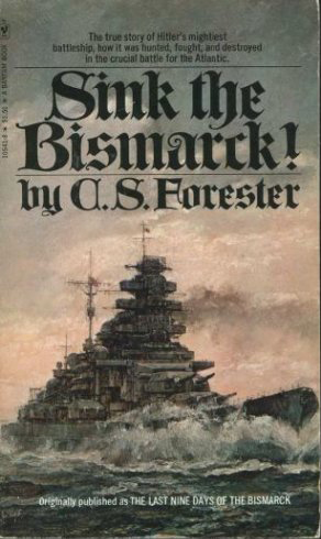
One of the books that made an impression on me as I was growing up in the 1970s was C. S. Forester’s Sink the Bismarck! Although it wasn’t the most factual account of the destruction of the the great German battleship, it did spark a life-long interest in me in Second World War naval warfare.
My other great interest while I was growing up was maps. That interest I eventually turned into a satisfying career.
Ten years ago I was surfing around the Internet and came across uboat.net, a detailed and thorough site that lists all of the ships sunk by German u-boats and their locations as well as the u-boats themselves. The site is great but the focus I found to be too limiting. U-boats played a major role in the Battle of the Atlantic but did not account for all the shipping losses in that theatre. Where were the ships sunk by mines or bombs or shells? Or, for that matter, what about the rest of the war, especially the naval war in the Pacific?
I looked about the Internet and quickly realized that no such database and/or map existed. There was a rather unsatisfactory map of World War II shipwrecks produced by SeaAustralia but it was grainy and static. Clearly, if I wanted to see such a map, I would have to create it.
And so I embarked on a project of mapping all of the ships sunk during the Second World War as a result of military action (i.e. no accidental sinkings). After 8 years of research I came up with a database and an interactive map that contained over 13,000 records. Since I published this mapping application in 2020 I have continued to research the Internet and hard copy sources for the locations of the 5,000 records for which I did not have location. This has continued to yield results and I have been able to add another 800 or so locations to the map.
Take some time with the mapping application and look up your favourite ship or location. There are bound to be mistakes so let me know if you find any.
Return to this site to learn of updates and other Second World War naval warfare maps.
Launch the mapping application to see the results.
Follow us on Instagram.

Hello,
I have just come across your wonderful site, but have noticed a certain vessel is missing.
In the summer of 1953, I was in the bay of Lubeck, to be precise opposite Scharbeutz.
Approximately less than one mile out from the beach at Scharbeutz, in a direct line east, was a salvage operation in progress.
The ship in question, was laying on its port side, and clearly a merchant ship of some kind. At the time , possibly two metres of the hull was above the waterline.
The vessel was being supported by two of the largest salvage vessels at the time, the “Energies” and the “Ausdauer”.
On our motor boat ride out to the site, we were informed that the vessel had been sunk in 1945, and was carrying a large number of passengers.
At the time, I was on holiday from my school located at Ploen, which is just north of Lubeck.
I have looked for information over the years, unfortunately without success.
However, it cannot be the “Cap Arcona” or the “Thielbek”, as both were salvaged in 1949.
Regards
LikeLike
I have two other vessels in my “not mapped” listing that state they were sunk in or around Lubeck: Castor, sunk 5 December 1944, and H C Horn (S 27), sunk 2 May 1945. It’s possible one of those was the ship you are referring to.
LikeLike