There were no updates to the database in November but a few in December:
3 records had edits to the date the ship sunk
5 records were moved to more accurate locations
1 new record was added
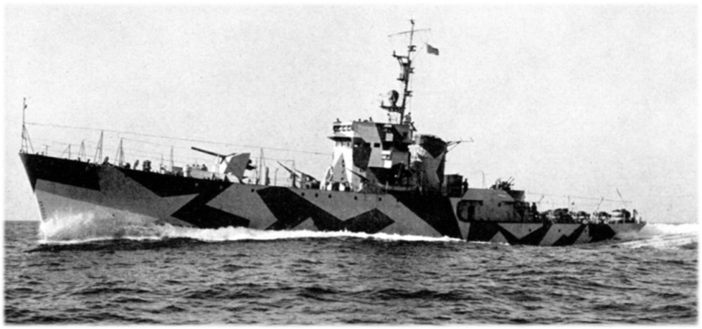
These days, since I seemed to have mined most of what is available online there aren’t many changes. But occasionally I do come across information that allows me to add in a new record. That was the case for the German corvette UJ 201 Egeria. krnicadive.com has a few shipwreck locations listed on its site, all within the Adriatic off its east coast. One of them was the Egeria. Included on the site is a detailed description of the events that led to its destruction on the last day of February, 1944. For a shortened description of the events, visit my Instagram post on the ship.
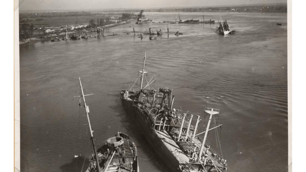
Some of the vessels sunk in the Garonne near Bordeaux in 1944
Most of the changes were tied to updated to ship sinkings around Bordeaux, France and Genoa, Italy. This is likely to be the last large update for some time.
Current total number of sunken ships mapped: 15,165
Current number of sunken ships on record but not mapped (due to no or inexact locations): 4,927
Frequently in my work I find a location for a sunken ships that is simply listed by the name of the harbour in which it sank. As the western Allies progressed on to the mainland of Europe, the Germans often sought to make whatever they left behind as useless as possible. Harbours, of course, were eminently useful to whoever had control of them and so they scuttled numerous ships in an effort to block the harbour and make any cleanup of them a long and arduous process (see Mud, Muscle, and Miracles: Marine Salvage in the United States Navy for a description of some of the challenges).
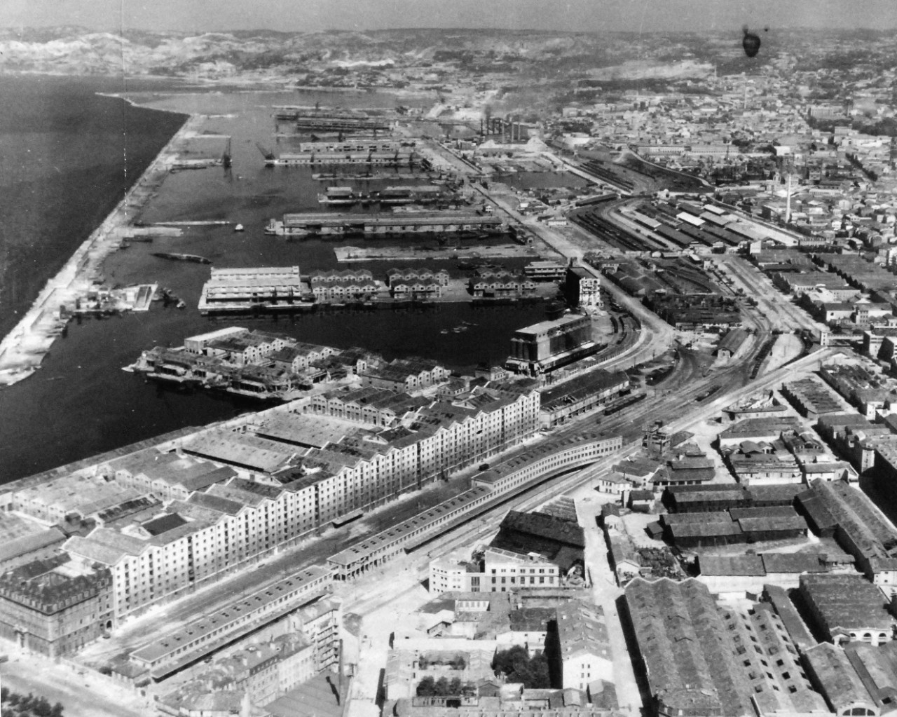
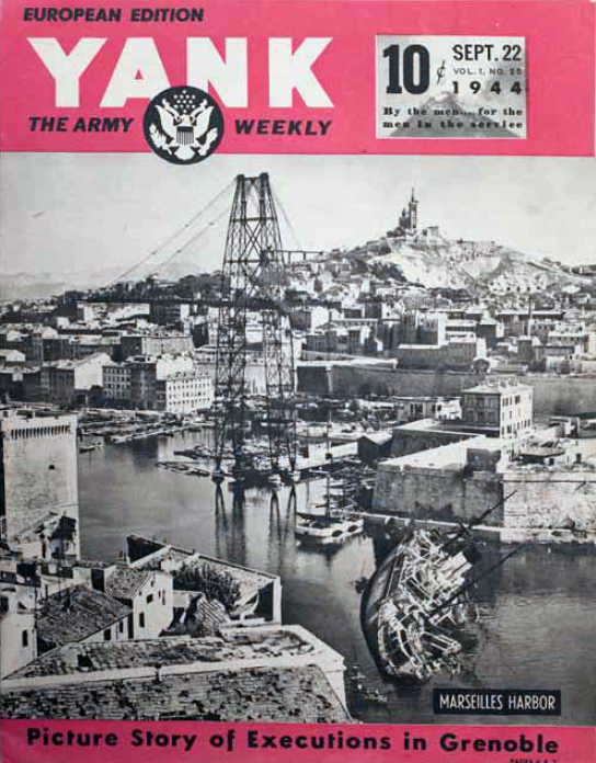
Aerial view of the harbour at Marseille, France in 1944. Note the two ships on the left-hand side of the photo (yet to be identified).
This was also the case for Marseille, France in the summer of 1944 where, according to a caption of another wrecked ship, 192 ships were wrecked (many presumably sunk). Unless there is a convenient map that displays both the names and the location of each wreck, determining the exact location for each sunken ship can be a monumental challenge.
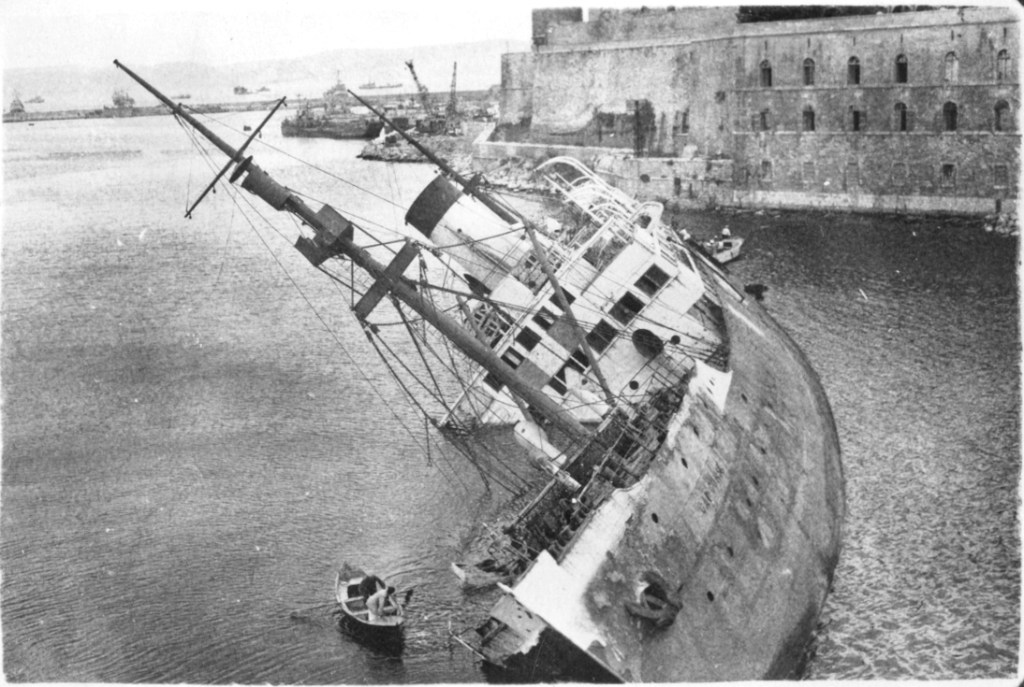
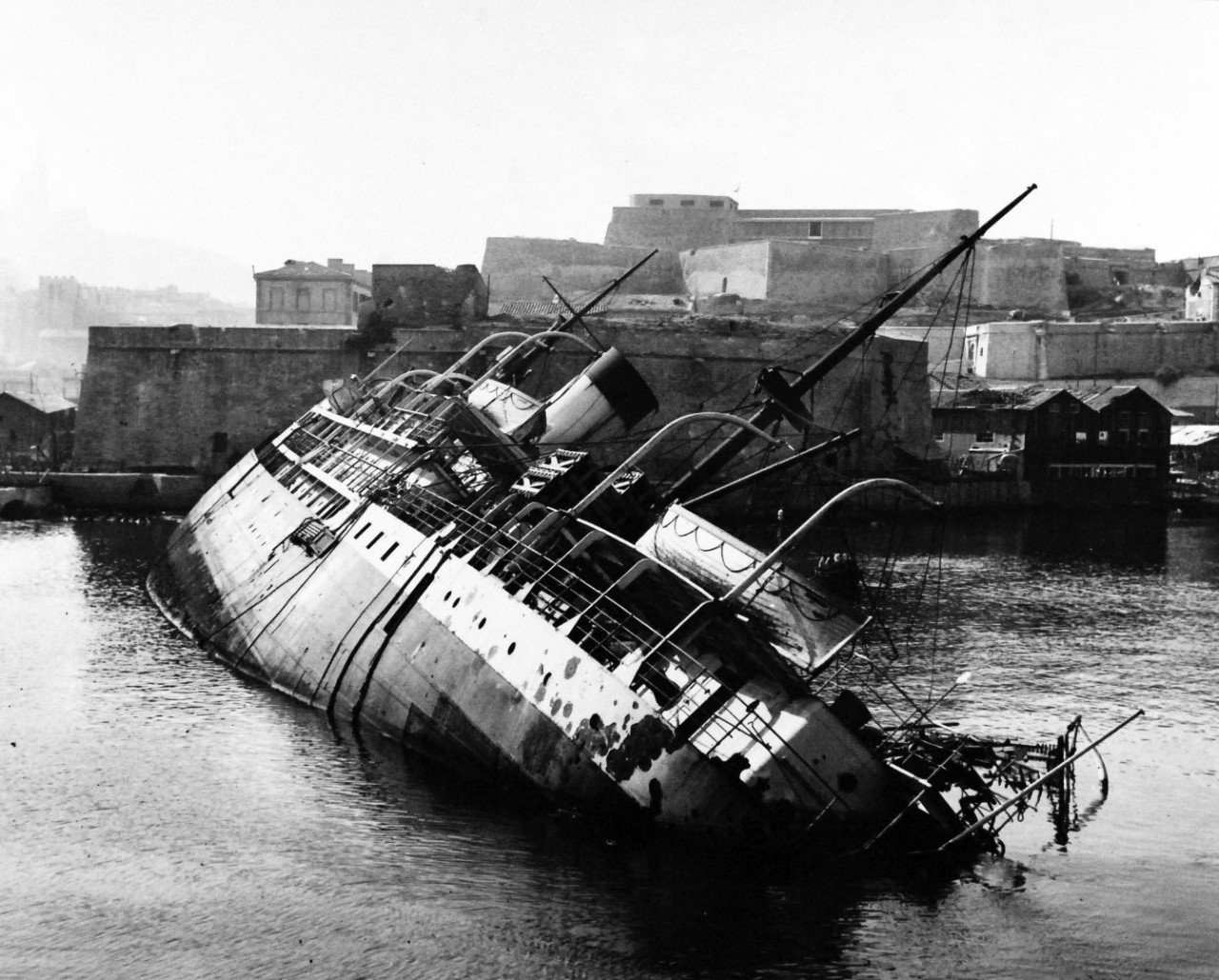
Cap Corse, a French cargo ship appropriated by the Germans during the Second World War, was scuttled by the retreating Germans at the entrance to Marseille’s old port. With a couple of strategically angled photos, it’s exact location was fairly easy to determine.
The Cap Corse on its side before Marseille’s Fort Saint Jean. Image source: Inch High Guy
I came across the image above from another blog site, Inch High Guy, where the ship is identified as the Cap Corse. Subsequently, I found other photos of the same ship from different angles to confirm the sunken ship’s resting place before it was cleared away. Below is one such photo of the same ship, but looking from the other side of the channel.
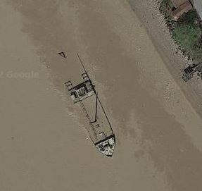
Rarely does it happen that the wreck of a ship sunk during the Second World War is still visible today. Frisco, an Italian cargo ship of 4,610 tons, was scuttled in late August, 1944 by German troops and is currently sitting in shallow water in the Gironde, making it easily visible – and easy to map.
Frisco as viewed from the shoreline. Image via Reddit
Image via Google Maps
The ship is viewable on Google Maps and other online map providers (Google seems to have the best imagery for it – see to the right). See for yourself.
Submarines were the single greatest cause of vessel sinkings during the Second World War – about 34% of the total 20,000 ships that were sunk. The Germans in their U-boats accounted for 2,955 of these vessels and collectively they totaled over 14 million tons of shipping. Less well known is the US submarine war against the Japanese. American submarines accounted for 1,994 vessels with a tonnage of 5.6 million. Further down the list was the UK who accounted for 1,625 vessel sinkings of 1.5 million tons. The Japanese, surprisingly, accounted for only 187 vessel sinkings of less than a million tons.
It is worth noting a couple of things about these numbers:
Not all ships listed in the database have a tonnage value. Records for the western Allies tend to be better and more complete and these were often the victims of German submarine attacks. Japanese records – the target of US and UK submarines in many cases – are less complete.
Many of the vessels sunk by US submarines were small vessels (less than 20 tons) including fishing vessels and small junks in use by the local population (See the records for USS Blenny, for instance).
Président Dal Piaz was a 4,866 tonne Tyne built passenger / cargo ship, built and launched in 1929 for the Cie Générale Transatlantique in Marseilles, France. In 1940, after the Italian invasion of the south of France, it was taken over by the government of Italy. In 1943, it was seized by the Germans after the Italian armistice and returned to the French in February 1944. In June of that year it was again seized by the French and was intended to be used as a blockship, blocking the harbour at Cassis, France when it was torpedoed and sunk by the British submarine Universal, pretty much in the spot where the Germans had intended to scuttle her. The air photo below makes it easy to map the location of her demise.
The evacuation of the Netherlands East Indies was chaotic, as were many during the Second World War. However much they may be planned in theory, evacuations during wartime rarely go smoothly, and even when they are deemed “successful” (such as the one at Dunkirk in 1940), in the moment, chaos reigns, as the pursuing enemy disrupts events with bombing raids. Sunken ships can still be located, however. It is surprising that anyone engaged in a battle for their life might think to record the exact location of their ship’s demise, but this is what happened during the evacuation of the Netherlands East Indies, March 1 to 8, 1942.
In his book The Allied Defense of the Malay Barrier, 1941 – 1942, Tom Womack provides a detailed account of the Japanese invasion of the Netherlands East Indies. He focuses on the naval and maritime aspect of the event and provides a grim look at the scale of the Allied defeat. In just seven days, Womack writes, 186 merchant and naval vessels were scuttled as the Japanese approached Soerebaja (now called Surabaya), Batavia (Jakarta) and Tjilatjap (Cilacep) on the island of Java. The locations of 59 of these scuttled ships has been mapped; the rest received hasty descriptions, such as “at Soerebaja” or “in the Donan River.”
HMS Exeter sinking on ! March 1942 in the Java Sea Credit: Wikimedia Commons
These numbers do not include the more than 50 vessels that were sunk at sea during their attempts to escape. These locations are mostly known, as the sinkings occurred one by one at the hands of Japanese naval personnel, who recorded them in their ship logs.
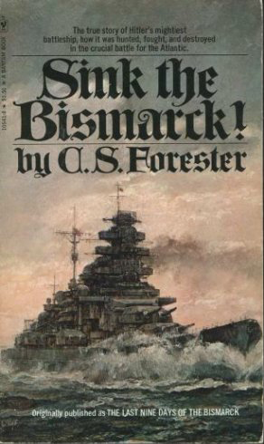
One of the books that made an impression on me as I was growing up in the 1970s was C. S. Forester’s Sink the Bismarck! Although it wasn’t the most factual account of the destruction of the the great German battleship, it did spark a life-long interest in me in Second World War naval warfare.
My other great interest while I was growing up was maps. That interest I eventually turned into a satisfying career.
Ten years ago I was surfing around the Internet and came across uboat.net, a detailed and thorough site that lists all of the ships sunk by German u-boats and their locations as well as the u-boats themselves. The site is great but the focus I found to be too limiting. U-boats played a major role in the Battle of the Atlantic but did not account for all the shipping losses in that theatre. Where were the ships sunk by mines or bombs or shells? Or, for that matter, what about the rest of the war, especially the naval war in the Pacific?
I looked about the Internet and quickly realized that no such database and/or map existed. There was a rather unsatisfactory map of World War II shipwrecks produced by SeaAustralia but it was grainy and static. Clearly, if I wanted to see such a map, I would have to create it.
And so I embarked on a project of mapping all of the ships sunk during the Second World War as a result of military action (i.e. no accidental sinkings). After 8 years of research I came up with a database and an interactive map that contained over 13,000 records. Since I published this mapping application in 2020 I have continued to research the Internet and hard copy sources for the locations of the 5,000 records for which I did not have location. This has continued to yield results and I have been able to add another 800 or so locations to the map.
Take some time with the mapping application and look up your favourite ship or location. There are bound to be mistakes so let me know if you find any.
Return to this site to learn of updates and other Second World War naval warfare maps.